


At GroundProbe, our industry leading LiDAR technologies are transforming the way that mining and civil construction engineers are monitoring underground movements and convergence. Using our advanced GML convergence monitor, GroundProbe delivers reliable and real-time detection of site deformation and convergence with sub-millimetre accuracy, helping to mitigate the typical challenges that come with underground site monitoring. Contact our team of experts to find the best monitoring solution for your project site.
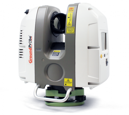
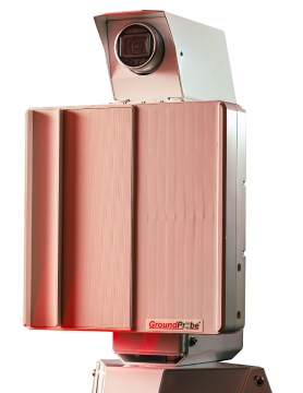
GML (Convergence Monitoring)
The GML - together with its Convergence Monitoring Module - is GroundProbe’s industry-disrupting underground monitoring solution. Capable of detecting rock and ground support movement with submillimetre accuracy, the GML offers a range of unprecedented features and benefits for underground monitoring.
Take a lookWhat is LiDAR?
LiDAR, also known as Light Detection and Ranging, is a remote sensing method that uses light in the form of a pulsed laser to measure ranges to the object being monitored. LiDAR technology, incorporated into the GMS and GML systems, follows a simple principle — throw laser light at an object on the earth surface and calculate the time it takes to return to the LiDAR source. This allows users to conduct geotechnical and convergence monitoring by calculating the time it takes the light to return to the LiDAR source and comparing this to previous measurements to determine if the movement is moving towards or away from the system.
LiDAR Scanning for Reliable Site Convergence Monitoring
In complex mining and civil construction environments, understanding ground movement and convergence is critical to maintaining effective site safety for all project stakeholders. With the challenge of capturing high-accuracy data in confined, hazardous, or low-visibility spaces, many geotechnical analysts are turning to LiDAR technologies for a comprehensive of their site structure. At GroundProbe, our advanced LiDAR technologies are trusted by mining and civil construction professionals all over the world – delivering GML convergence monitoring solutions that provide consistent and accurate site data to mitigate risks of ground movements.
How Does LiDAR Monitoring Work?
As a leading LiDAR technology, our GML convergence monitor operates by sending underground laser pulses to the tunnel walls or surrounding rock face. As a result, these pulses reflect back to the sensor, recording the time taken for each one to return. Using this method to compare current scans with baseline measurements, project managers can identify even the smallest changes in the rock or structure and take the necessary actions to mitigate this risk.
How Do LiDAR Technologies Support Site Safety?
The ability to continuously and accurately monitor underground convergence plays a vital role in protecting workers, infrastructure, and operations during mining and civil construction projects. To optimise site safety during underground projects, GroundProbe’s GML convergence monitoring systems can:
- Identify small-scale movement before they become a threat
- Reduce the need for manual, in-person inspections in confined or unstable areas
- Provide real-time alerts for fast response
- Support compliance with industry regulations and reporting standards
Plus, using consistent data captures, these convergence reports will improve planning and risk mitigation strategies, ultimately leading to fewer disruptions and more predictable operations.
Discover GroundProbe’s Advanced LiDAR Technologies
GroundProbe’s GML convergence monitor is purpose-built for underground environments, offering durable, high-performance LiDAR monitoring in some of the most challenging conditions. With key features including; sub-millimetre accuracy, autonomous operation and real-time data streaming, robust construction, and so much more – it’s no wonder that our LiDAR technologies are adopted worldwide.
Backed by expert geotechnical support and a global presence, GroundProbe is the trusted partner for mining and civil projects that demand high-resolution, real-time underground monitoring. If you’re looking to enhance the safety and operational awareness of your mining or construction project, contact our team today to learn more about how our GML convergence monitor can support your site monitoring needs.
Lidar FAQs
What Makes LiDAR Monitoring Different from Radar Site Monitoring?
While both LiDAR and radar technologies are used for geotechnical monitoring, the key difference lies in how they collect data. LiDAR uses laser pulses to measure distance and create high-resolution 3D surface models. In comparison, radar systems (such as GroundProbe’s SSR range) use radio waves to detect movement over broad areas which is mostly used for large-scale slope stability monitoring. Whilst both technologies excel in their own ways, LiDAR works best for high-precision, close-range applications such as convergence and deformation monitoring in challenging environments.
How Accurate are GroundProbe’s LiDAR Sensors?
GroundProbe’s LiDAR systems are engineered for exceptional accuracy, delivering sub-millimetre precision in real-time. This level of detail allows site operators to detect the smallest structural movements, enabling proactive responses before risks escalate. The accuracy is consistent across large scanning areas, making our LiDAR technology a trusted tool for both surface deformation and underground convergence monitoring in challenging mining and construction environments.
Can LiDAR be Used Underground?
GroundProbe’s LiDAR systems are specifically designed for underground environments! Our LiDAR technology enables precise convergence monitoring in tunnels, declines, and other confined spaces, where typical radars may struggle. These systems were built with intention, designed to withstand harsh underground conditions such as low light, dust, and humidity.
What is the Difference Between GMS and GML Monitors?
GroundProbe’s GMS (Geotechnical Monitoring Station) and GML (Geotechnical Monitoring LiDAR) monitors both use LiDAR technology, but you’ll find that they’re designed for different applications. GMS is typically used above ground, providing high-resolution monitoring of pit walls, slopes, and infrastructure. In comparison, GML is engineered for underground use, focusing on convergence monitoring in tunnels and confined spaces. It autonomously scans cross-sections of underground voids, detecting shape changes with extreme precision.
Based on your site’s needs, both systems can offer real-time data, sub-millimetre accuracy, and seamless integration with GroundProbe’s monitoring software, allowing for efficient risk management in diverse mining settings.