


Our industry-leading geotechnical software solutions was designed to support all types of GroundProbe’s products, enabling the acquisition, processing, and visualisation of the data that our hardware collects. Each of our geotechnical software solutions provide cutting-edge features for various industry applications, from defining scan areas, displaying data for analysis, charting, alarming, reporting, data aggregation, multi-sensor analysis and more! Find the best geotechnical software solution for your project today.
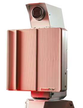
MonitorIQ® Desktop Geotechnical Software
MonitorIQ® Desktop is our dedicated geotechnical analysis platform and the standard platform across all our systems and sensors.
LEIA MAISAn Innovative & Leading Approach to Geotechnical Analysis Software
Powerful geotechnical data analysis defines every successful mining project and ensures informed decision-making. At GroundProbe, we are a leading provider of advanced geotechnical software solutions, offering a range of innovative technologies that help companies to better understand and manage geotechnical risks. Our industry leading technologies help to analyse and mitigate risks across varying mine sites and geotechnical landscapes, ensuring a holistic view of the project site’s condition and overall health.
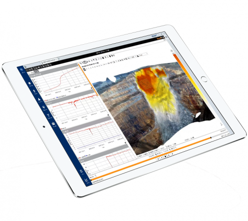
Intentionally designed to provide premier data aggregation for geotechnical monitoring, GroundProbe’s geotechnical software allow for an accessible and comprehensive analysis of site-wide information. By standardising data from all sensors, including GPS, radar, LiDAR, and InSAR, your team can seamlessly import, view and compare data all in one user-friendly dashboard.
Geotechnical Data Aggregation Software
At GroundProbe, our advanced geotechnical softwares cater to a range of different site needs; from focused safety surveillance to large-scale operations, and more. That’s why our range of geotechnical software solutions is built to scale.
Our MonitorIQ® Desktop geotechnical software is a dedicated geotechnical analysis platform that allows users to view and analyse data from single or multiple GroundProbe sensors. These seamless capabilities connect all your site insights and analysis into a singular easy-to-use software using powerful visualisation and critical alerting features.
For more complex or large-scale operations, MonitorIQ® Enterprise offers a fully integrated and scalable platform that brings together data from a wide variety of geotechnical and environmental sensors. By effortlessly aggregating data inputs such as radar, InSAR, GPS, and LiDAR into a singular dashboard; GroundProbe empowers cross-functional teams to make faster and more informed decisions to optimise mining operations at scale.
Seamless On-Site Geotechnical Analysis Software
Our advanced geotechnical analysis software enables real-time decision making to ensure optimal site safety and efficiency. With the ability to access and monitor site data instantly, on-ground or remote teams can proactively manage risks with intuitive data-led insights. Beyond the comprehensive capabilities of the MonitorIQ suite, our seamless interface allows a range of site personnel to accurately understand and interpret data with ease – creating the perfect platform for geotechnical engineers, site managers, operators and more. Get in touch with the friendly team at GroundProbe today to discover how our intuitive geotechnical softwares can support your project today.
Discover The Best Geotechnical Software Solution for Your Site
Looking for reliable and intuitive geotechnical software solutions? GroundProbe’s software allows you to easily understand and manage risks, optimise operations, and improve safety across your mining site. From local to large-scale operations, our team can help to tailor your on-site software to meet the exact demands of your site and project. Contact GroundProbe today to learn more and enquire online now.
Geotechnical Software FAQs
What is the best geotechnical software for mining?
Choosing the best geotechnical software for your mine site depends on a variety of factors. From the experience levels of your team to the scale of your operations. That’s why at GroundProbe, our team of experts are here to help you understand the exact insights your site needs. Our MonitorIQ solutions offer a diverse solution depending on your needs; plus, with tailored support and training, our team of experts will ensure that your key personnel can understand and interpret the platform for maximum efficiency. To find the best geotechnical software for your mine site, get in touch with our friendly team today.
What is geotechnical software used for?
Geotechnical software plays a crucial role in maintaining site safety, efficiency and accuracy. A comprehensive geotechnical software monitors, analyses and manages ground movement and stability risks to provide reliable insights for project operations and immediate action. GroundProbe’s MonitorIQ suite offers all these capabilities and more in an intuitive format that allows a range of key site personnel to understand data and inform site movements.
What are the four types of geotechnical?
Geotechnical engineering often involves four “types” of focus, each playing a key role in understanding and managing ground movements and behaviour. These include:
- Soil mechanics: Understanding soil properties and how they affect structures built on or in the ground.
- Rock mechanics: Analysis of the strength and behaviour of rock formations. This is especially important in mining and tunnelling projects.
- Slope stability: Monitoring and assessing the potential for landslides or slope failure in natural or engineered landscapes.
- Foundation engineering: Evaluating foundations for structures based on geotechnical data, ensuring they remain stable under varying ground conditions.
GroundProbe’s range of geotechnical software solutions aim to support these key areas of analysis, providing real-time monitoring, predictive analysis and long-term site assessments. For more information, enquire today.