


Maximising Safety in Challenging Conditions: A Multi-Site Approach with GSS and GroundProbe

OVERVIEW
PT Pamapersada Nusantara (PAMA) is one of the world’s largest coal mining contractors and a key player in Indonesia’s mining industry. A subsidiary of PT United Tractors Tbk, PAMA operates across a wide range of complex geological settings and has established a strong reputation for technical innovation and safety.
PAMA supports operations across six major coal mine sites, each with its own unique geotechnical challenges:
- BTSJ (Bangko, South Sumatra): Known for weak layer potential risk
- BAYA (Samarinda, East Borneo): Monitoring focus on high walls, low walls, and disposal areas
- KIDE (Batu Kajang, East Borneo): Characterised by nearly vertical lithology and deep mining
- KPCS (Sangatta, East Borneo): Historical failure events in the disposal area
- KPCT (Sangatta, East Borneo): Soft material concerns
- MTBU (Tanjung Enim, South Sumatra): Monitoring of old dumps and weak layers.
The diversity in site characteristics required a tailored, data-driven approach to slope monitoring—one that balances responsiveness, mobility, and continuous insight across multiple high-risk areas.
CHALLENGE
As operations progressed at multiple sites, maintaining slope stability in varied and often unpredictable ground conditions became a critical challenge. Geotechnical risks ranged from soft materials and steep dips to historical instability in dumping areas.
Two primary needs emerged:
- Optimal Radar Deployment: Ensuring radar units were placed in the most effective positions based on suitability analysis and geotechnical risk assessments
- Maximising Uptime and Early Warning: Enhancing the operational efficiency of radars to provide uninterrupted, high-precision monitoring and early alerts across all six sites
“Our goal was to ensure that every radar unit was positioned based on risk priority and that operational uptime was maximised to provide timely, actionable data for slope stability decision-making.”
— Syainal Abidin, Mine Geotechnic Expert, PT Pamapersada Nusantara
SOLUTION
To address these challenges, PAMA worked closely with GroundProbe’s Geotechnical Specialist Services (GSS) and Indonesia Operations team to implement a site-specific strategy for each location. The integrated solution involved the deployment of GroundProbe’s SSR-XT radar system, MonitorIQ Desktop, and ongoing technical guidance from GSS.
Key elements of the solution included:
- Site-Specific Radar Suitability Analysis: Selection of optimal radar positions based on terrain risk, geological profiles, and historical data
- Mobile Deployment Strategy: Enabling flexible, targeted coverage across different pits and disposal areas as conditions evolved
- Operational Optimisation: Improvements to radar uptime through regular maintenance, robust network infrastructure, and efficient refuelling and relocation protocols
- Remote and On-Site GSS Support: Including radar health checks, data interpretation, and real-time guidance
- MonitorIQ: This software has provided rapid, precise data analysis, exceptional visualisation to detect trends and the ability to send alerts for immediate action.
“Improving the operational aspects of radar use, like checking connectivity, maintaining uptime, and reviewing movement trends, was as critical as deploying the radar itself.”
— Syainal Abidin, Mine Geotechnic Expert, PT Pamapersada Nusantara
RESULTS
The multi-site approach delivered tangible benefits:
- Improved Risk Visibility: High-resolution radar data enabled early detection of movement, even in low-visibility or high-risk areas
- Operational Resilience: Uptime was enhanced thanks to systematic maintenance and better planning around connectivity and relocation
- Data-Driven Decisions: MonitorIQ dashboards provided clear, real-time views across sites, helping geotechnical teams act faster
- Stronger Internal Capability: GSS training and support helped build internal competency, allowing PAMA’s geotechnical experts to confidently interpret radar data and validate alarms
“We help keep people safe. Our team monitors in real time, spots issues early, and gives sites the time to act. That’s what makes this work meaningful.”
— Rachmat Hamid Musa, Head of Geotechnical Specialist Services (GSS), GroundProbe
FUTURE ACTIONS
PAMA and GroundProbe continue to strengthen their collaboration, with future initiatives including:
- Expanding radar coverage to new and evolving risk areas
- Conducting advanced GSS-led training to support internal self-reliance
- Integrating additional sensor types into a unified monitoring environment for greater oversight
“Every site speaks a different geological language, but through the right technology and the right team, we can interpret what the ground is telling us and act before failure occurs.”
— Syainal Abidin, Mine Geotechnic Expert, PT Pamapersada Nusantara
-END-
 |
 |
 |
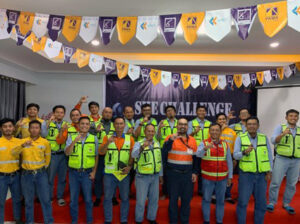
| Ckristian Sulo, Coordinator – Geotechnical Engineer, and part of GroundProbe’s Geotechnical Specialist Services (GSS) team, delivered a geotechnical awareness session to the on-site team at the PAMA KPCT site. |
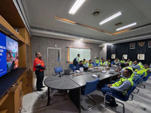
Ckristian Sulo, Coordinator – Geotechnical Engineer, led a geotechnical awareness session at the PAMA BAYA site, sharing practical insights into slope stability and monitoring. |
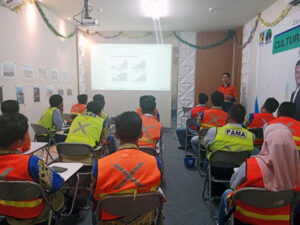
Alif Irsyad, Coordinator – Geotechnical Engineer, delivered a detailed analysis of geotechnical slope monitoring at the PAMA BTSJ site, supporting informed decision-making on site safety. |