Slope failures and other geotechnical hazards can be identified early thanks to GroundProbe’s slope stability monitoring systems, which are designed to give constant, real-time visibility of ground movement. Keeping an accurate, high-resolution picture of slope behaviour is essential for both safety and productivity in settings where slope instability presents serious risks, such as open-pit mines, tailings dams, and major civil construction projects.
LiDAR systems, background monitoring technologies, and satellite-based InSAR services are used in conjunction with our radar-based monitoring solutions, such as the SSR-XT, SSR-Omni, and SSR-SARx. When combined, these systems provide sub-millimetre accuracy in measuring ground displacement and deformation, giving operators useful information to stop slope instabilities before they worsen.
SSR-Agilis
The SSR-Agilis is a standalone vehicle monitoring system designed to protect personnel and valuable equipment in active working areas of a mine site.
Take a look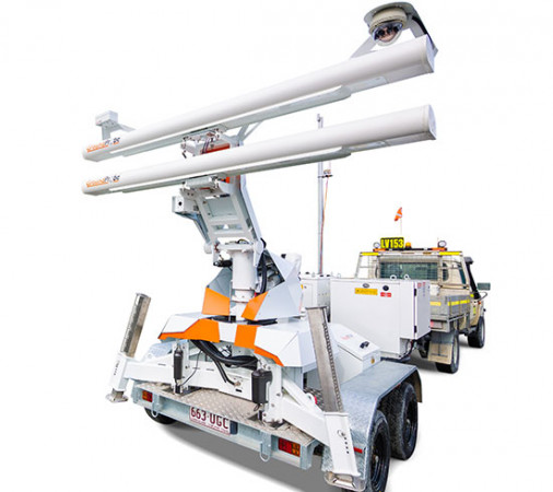
SSR-Omni
The SSR-Omni is a full-coverage, high-resolution monitoring solution that delivers precise, actionable data.
Take a look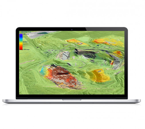
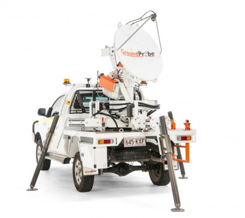
InSAR Service
The GroundProbe InSAR Service, in partnership with 3vGeomatics (3vG), is an effective tool for monitoring and detecting surface movement. It uses satellite-based radars which conduct scans every time they pass over the mine site.
Take a look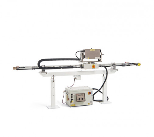
SSR-SARx
Designed to identify long-range risks and hazards, the SSR-SARx is a long-range and high-resolution system for the monitoring of tailings dams. The SSR-SARx is a 2D Synthetic Aperture Radar (SAR) designed to detect even the smallest of movements over long periods of time.
Take a look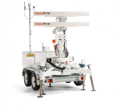
SSR-FX
The SSR-FX is a monitoring system designed to provide geotechnical peace of mind. An expert tool for risk and hazard identification, the SSR-FX is a 2D Real Aperture Radar (RAR) specialising in detecting movement across vast mine sites over a long period of time, even in non-critical areas.
Take a look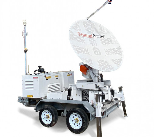
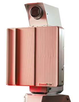
SSR-XT
A tactical and targeted solution, the SSR-XT monitors movement that poses a potential or immediate threat to mine slopes, tailings dams, and surrounding infrastructures in general. The strong precision of its 3D Real Aperture Radar (RAR) ensures that areas of concern are monitored in real-time to ensure safety-critical management of at-risk areas.
Take a lookCutting-Edge Technology for Slope Stability Monitoring
The Challenges of Monitoring Slope Stability
Slope monitoring poses a special set of difficulties that may jeopardise effectiveness and safety. Heavy rainfall, seismic activity, and seasonal weather changes can all hasten slope movement, and traditional monitoring is challenging to set up or maintain in many mining environments due to their remote or dangerous locations.
Slope movements can be subtle and frequently occur gradually, making them difficult to detect without highly sensitive equipment. This is perhaps the biggest challenge. On the other hand, slopes can also fail quickly, necessitating the use of technology that can detect them in real time and provide prompt alerts.
Because of this, GroundProbe’s slope monitoring systems are built to run consistently and dependably, gathering enormous volumes of data to aid in long-term trend modelling and predictive analysis. Our technology guarantees that operators can react swiftly and confidently to shifting ground conditions thanks to high-resolution imaging, automated scanning, and sophisticated alarm systems.
Slope Stability Monitoring Solutions at GroundProbe
GroundProbe offers a comprehensive suite of solutions to suit different site conditions and monitoring requirements:
- SSR-XT: Wide-area radar monitoring designed for detecting slope movement across large pits and waste dumps.
- SSR-Omni: 360-degree radar providing complete situational awareness of pit walls and surrounding areas.
- SSR-SARx: Ultra-sensitive radar ideal for detecting subtle, long-term deformations that may go unnoticed by less advanced systems.
- SSR-FX: High-frequency, fast-update radar optimised for detecting rapid slope movements and dynamic failures across benches and high-risk zones.
- SSR-Agilis: Portable, agile radar for targeted monitoring and quick deployment – ideal for short-term works, ramps and critical infrastructure where precision and flexibility matter.
- InSAR Service: Satellite-based monitoring that complements ground radar, offering broad-area data and long-term deformation tracking.
MonitorIQ® software, which offers sophisticated analysis, data visualisation, predictive modelling, and reporting, supports all these solutions. When these technologies are combined, mining and civil operators are guaranteed to have the resources necessary to control geotechnical risk in a variety of settings.
Manage Your Slope Stability Monitoring with GroundProbe
Are you looking for a high-precision, dependable method of slope stability monitoring that will empower your team to act before problems worsen? GroundProbe’s slope monitoring Systems, supported by regional geotechnical specialists and round-the-clock technical assistance, provide continuous, real-time insights into ground movement.
Contact GroundProbe today to learn more about how our slope stability monitoring solutions can safeguard your operations and help you proactively manage risk.
Slope Stability Monitoring FAQs
How does slope stability monitoring differ from general geotechnical monitoring?
Slope stability monitoring concentrates on pit walls, embankments, and naturally occurring or artificially created slopes, whereas geotechnical monitoring encompasses a broad range of ground behaviour and structural stability. Continuous slope monitoring is crucial for identifying both slow-moving and fast-moving deformations in these regions because they carry a high failure risk for mining and civil projects.
H4: How accurate are GroundProbe’s slope stability monitoring systems?
The SSR-XT, SSR-Omni, and SSR-SARx are among our radar systems that are designed for sub-millimetre accuracy. As a result, mine operators can react quickly and prevent larger-scale slope failures by detecting even the smallest ground displacements. This guarantees accurate, real-time analysis and predictive modelling when combined with our MonitorIQ® software.
Can slope stability monitoring be automated or remotely operated?
Yes. Every GroundProbe slope monitoring system is completely automated and has remote control functionality. After being deployed, they monitor specified slopes continuously and send data to centralised platforms for alerting and visualisation. This lessens the need for workers in dangerous situations by enabling round-the-clock monitoring from control rooms or off-site locations.
What types of site benefit from slope stability monitoring?
Open-pit mining, tailings dam management, civil construction projects (such as highways and tunnels), and quarries all make extensive use of slope monitoring. Continuous slope stability monitoring will be beneficial in any setting where slope movement could endanger operations, infrastructure, or safety.
What makes GroundProbe’s slope stability monitoring unique?
Our systems integrate software for predictive analysis and user-friendly visualisation with radar precision that leads the world. But it’s our local knowledge and assistance that really makes GroundProbe stand out. With geotechnical engineers and technical experts on call around-the-clock, we provide operators with the information, insights, and support they need to take decisive action.
